Bing Maps Streetside Imagery Now Integrated into OpenStreetMap iD Editor
Microsoft has a long history of working with the community to help improve OpenStreetMap . This includes being the first company to provide aerial imagery to the community for editing and, more recently, our release of almost ten million building footprints. We continue to have an interest in fostering a thriving and growing community of both contributors and users of OpenStreetMap.
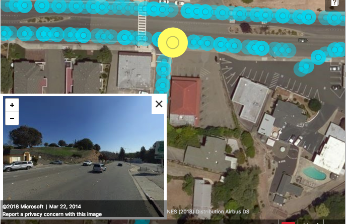
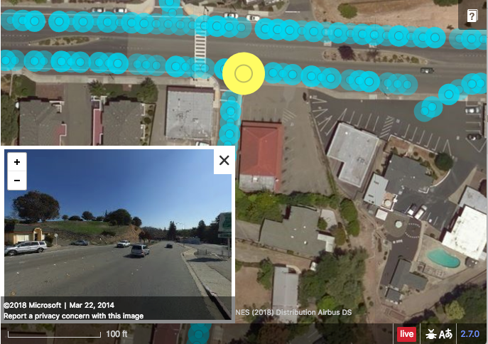
This week Microsoft is integrating its Streetside imagery for the United States into iD, a popular web-based editor for contributing to OpenStreetMap. This is the same imagery currently visible on Bing Maps now embedded into a popular editing application initially developed and now maintained by Mapbox. Our aim is that it continues to encourage the community to contribute and improve OpenStreetMap.
The Streetside imagery covers more than 80% of the US population with 360 degree views. The massive imagery dataset covers approximately 1.6 million kilometers and takes nearly 5PB of storage! This imagery when viewed in conjunction with Bing imagery along with existing data in OpenStreetMap represents a significant increase in verifiable ground truth for OpenStreetMap contributors.
– Bing Maps Team
Source: Bing Blog Feed